Introduction
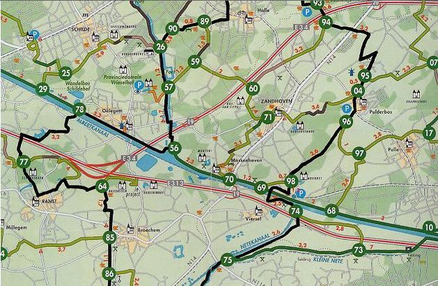
The ‘nodes’ (‘knooppunten’) are the points where these cycling paths intersect. Each node in the network is numbered. You can use these nodes to map out a cycling itinerary. You decide for yourself how long you want the trip to be and where you want to go.Just have a brief look at the map before you set off. Make a list of the nodes you want to cycle through. Then add up the distances between the nodes and you’ll know exactly how long your trip will be. If you’ve done your homework properly then all you’ll need to do during the trip is keep an eye on the node numbers.
The excellent signposting takes care of the rest! At the crossroads, forks and slip roads between the nodes there are rectangular signs with directional arrows and the number of the node you’ll be riding towards. There are also signs indicating the way to the centre of villages or major tourist attractions, and signs that show when you’re approaching a node.
Cycle Node Planner
More Information
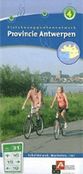
 Province of Antwerp
- Province of East-Flanders
- Province of Flemish-Brabant
- Province of Limburg
- Province of West-Flanders
Accomodations
Fietsroute.org offers you the completeBed and Breakfast Guide.
Province of Antwerp:
Cycle Network Antwerpse Kempen
Cycling in the Antwerpse Kempen means you get to pedal in a scenery of forests, meadows and canals, along beautiful sroutes which are safel, level, wind-sheltered and perfectly singposted. That is what the Antwerp Kempen cycle node network offers you. 2000 kilometers of carefully selected cycle paths, showing you the most beautiful corners of the region. During your trip the numbered green-white signs will show you the way. Order Map1 |
 Order Map 2 |
For more detailed information about the Cycle Network Antwerpse Kempen consult the website of the Tourism Office of the Antwerpse Kempen: www.antwerpsekempen.be |
 Order Map 3 |
 Order Map 4 |
Cycle Network Scheldeland
Cycle along towpaths and dike roads through the decor of Stille Waters (Still Waters) a Flemish television series. Ferrymen take you from one bank to the other. Explore peaceful villages, safely hidden under the dike.Walk through the luscious greenery and chat about your next meal. Or better still, lean against the rail of a boat and search the bank to determine who lives where on the water edge, without making a distinction between man and beast.
 Order Map |
 Order Map |
For more detailed information about the Cycle Network Scheldeland consult the website of the Tourism Office of the
Scheldeland: www.scheldeland.be |
Province of East-Flanders:
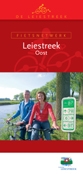
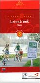
Cycle Network Leiestreek
The Leie (La Lys in France) is the major tributary of the Schelde in Flanders. This portion of the river is basically wild, meandering through flat farmland with occasional picturesque villages. Passage on most of this section is limited to 300 tons - in effect only pleasure boats. Much of the riverside has been divided into large lots, which have the greatest collection of large mansions.Discover the villages of Afsnee, Sint-Martens-Latem, Deurle, Sint-Martens-Leerne, and the Castel of Ooidonk. Along the way you pass through some of the poshest housing development in Belgium, particularly in the Latem area. The houses along the river tend to be mansions with very large grounds. Ooidonk was founded in the 12th century. What you see today is mostly 16th. The chateau is approached from Bachte-Maria-Leerne, on a road running south from the church (12 - 16th centuries, rehabbed 17th century). (There are several pubs on the two main streets of the town.)
Kortrijk lies in the Belgian Province of West Flanders, on the river Leie. Kortrijk dates from Roman times, when it was called Cortoriacum. Destroyed by the Normans, it was rebuilt in the 10th century by Baldwin III, count of Flanders. The town became an important center of trade and at its height had a population of about 200,000 The river Leie comes from France and enters Kortrijk on the site of the "Broeltorens", two medieval towers that are the only remaining witnesses of the former city fortifications, destroyed in 1684 by the troops of Louis XIV of France. Both towers date from the 12th and 13th century.
Order Map |
Order Map |
For more detailed information about the Cycle Network Leiestreek consult the website of the Tourism Office of the
Leiestreek: www.leiestreek.be |
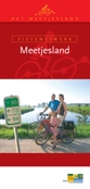
Cycle Network Meetjesland
The Meetjesland is a Belgian countryside region between the cities of Ghent and Bruges, at the border with the Netherlands nearby the North Sea. Eeklo is the central town, and beside Eeklo, Aalter, Evergem, Maldegem and Zelzate are important economic centres.The region has a variety of landscapes: at the North we have typical creeks, recovered from the sea, the south is more sandy and wooded. 80% of the area is cultivated by farmers (2300 agricultural properties).
 Order Map |
For more detailed information about the Cycle Network Meetjesland consult the website of the Tourism Office of the
Meetjesland: www.toerismemeetjesland.be |
Cycle Network Scheldeland
Cycle along towpaths and dike roads through the decor of Stille Waters (Still Waters) a Flemish television series. Ferrymen take you from one bank to the other. Explore peaceful villages, safely hidden under the dike.Walk through the luscious greenery and chat about your next meal. Or better still, lean against the rail of a boat and search the bank to determine who lives where on the water edge, without making a distinction between man and beast.
Order Map |
Order Map |
For more detailed information about the Cycle Network Scheldeland consult the website of the Tourism Office of the
Scheldeland: www.scheldeland.be |
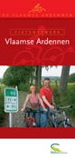
Cycle Network Vlaamse-Ardennen
If you wish to discover the Flemish Ardennes by bike without stopping too much, you can take the valley ways e.g. the way next to the Scheldt which leads from Gavere to Kluisbergen. Or you can take the Mijnwerkerspad, a path which was used by miners, true the Zwalm valley. Anyone who likes lovely panoramas should leave these roads and should take the winding roads to the top of one of the hills. The hightest hill is the Hotond near Ronse. This hill has an altitude of 151 m and is the hightest point of East Flanders. There you will have a breathtaking view over the entire Flemish Ardennes. An old windmill over there is used as a watchtower.The Cycling Network Flemish Ardennes chooses both difficult hills and flat roads. Slopes are very clearly indicated on the map in order to allow you to avoid them or, for sportsmen, search them. This means that you can map out a family tour by bike or a small Tour of Flanders on the 830 km cycle network of the Flemish Ardennes.
Discover cities like Zottegem, The Gate of the Flemish Ardennes offers great possibilities for the nature-lover and the more active tourist. Visit the castle of Leeuwergem with its wonderful parc and the internationally famous open air theatre. The Domain of Breivelde presents a 19th-century romantic garden, which has grown into a real arboretum, containing 54 different kinds of rare trees. From the flat landscape in the north west to the steep hilly country in the south east the scenery breathes a spirit of quiet and serenity.
Oudenaarde is situated in the heart of the Flemish Ardennes. The beauty of the landscape is renowned with ever changing views, green valleys and hills, many picturesque villages, old mills, castles...
 Order Map |
For more detailed information about the Cycle Network Vlaamse-Ardennen consult the website of the Tourism Office of the
Flemish-Ardennes: www.toerismevlaamseardennen.be |
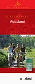
Cycle Network Waasland
In the Waasland you will cycle or walk on the trail of the roguish scoundrel Reynard the Fox. Water is never far away! Whether you opt for a cycle trip along the Durme Dike, a boat trip on the Scheldt or a walk along the lilies floating on the Moer Canal, the waterside is a delightful place to stay. Or take a step back in time, in the Rupelmonde of the famous cartographer Mercator.The many welcoming small towns in this region bubble with art of living and cultural richness. So much nature and culture wets your appetite… Taste horse sausage in Lokeren, eels in Temse or feast on our famous Waasland pies.
 Order Map |
For more detailed information about the Cycle Network Waasland consult the website of the Tourism Office of the
Waasland: www.toerismewaasland.be |
Province of Flemish-Brabant:
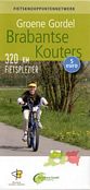
Cycle Network Brabantse Kouters
The landscape of the Brabantse Kouters is rich and varied. Brooks, streams, and rivers wind their various courses across the valleys. Here, agriculture and garden culture rules the roost. Witnesses to this are the many beautiful and large farms and wide-ranging meadows and cultivated and carefully manicured lands. A host of historical families and institutions placed their stamp on the Brabant Kouter region.There were the Berthouts, the lords of Grimbergen, and the lords of Asse. The Abbeys of Grimbergen, of nearby Affligem, and even the Gent-based Sint-Baafs Abbey possessed large estates in this region. Today, one cannot fail to notice the intrusive advance of urbanisation. Everywhere, the breath of our capital permeates the air.
The region of Brabant Kouters invites you to lose yourself for a few hours inside its natural beauty and its history. Some top attractions: the National Botanical Garden of Meise, Grimbergen with its basilica, its mills, the Public Observatory, and the Museum for Ancient Techniques. And it surely goes without saying that you won’t want to forego a visit to the Palm Brewery estate and the impressive stud farm of the Brabant drafthorse at the castle of Diepensteyn.
 Order Map |
For more detailed information about the Cycle Network Brabantse Kouters consult the website of the Tourism Office of the Brabantse Kouters: www.brabantsekouters.be |
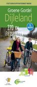
Cycle Network Dijleland
The Dijleland region invites you to start cycling. A signposted routing network spanning more than 300 km in length will get you from north to south and vice versa. But if you prefer to take it a little easier, stop off at the Royal Museum of Central Africa (Tervuren), the Belgian Endive Museum (Kampenhout), or you may prefer to partake of a cosy picnic in Heverleebos, or in the Meerdaal or Zoniën woods.Looking for some cool temperatures? Follow the watercourses of the Dijle, Demer, or the towpath along the Louvain-Dijle Canal. Combine a visit to Dijleland with a visit to the capital of Flemish-Brabant: the famous university city of Louvain. Discover The magnificent 15th century town hall.
All through the year the city of Leuven presents a lively atmosphere because of the many students from all over Belgium (and the world). Especially in the evening, and certainly at night, the many bars and students cafés, spread all over the town, guarantee that there is always something happening. Very popular is the area around the 'Oude Markt - Old Market' .....
 Order Map |
For more detailed information about the Cycle Network Dijleland consult the website of the Tourism Office of the
Dijleland: www.dijleland.be |
Cycle Network Hageland
Disover the 'Hageland' region, if offers unspoiled scenery and sleepy villages as well as six dynamic provincial towns. Hageland is a walker's paradise with many signposted walks.You can also cycle along the interconnecting bicycle network, past courtyard farms and Roman "tumuli". A little further on, the Horst Castle proudly stands guard in the middle of the lake. And the children? They are already splashing around in the open-air swimming pool of the provincial domains in Kessel-Lo and Diest. Or are we talking about nature lovers? In Zoutleeuw, their shadows are reflected in the lake at Het Vinne, a unique ecological creation! Order Map |
For more detailed information about the Cycle Network Hageland consult the website of the Tourism Office of the
Hageland: www.hageland.be |
Province of Limburg:
Cycle Network Limburg
Situated on the Dutch border, Limburg is the easternmost province in Flanders, and the foremost fruit-growing region in the country. The lively, friendly market town of Hasselt is the provincial capital. It boasts a car-free historic center, with building dating back as far as the 11th century. Genk is another recommended stop. The city of 63,000 people is home to a zoo, a planetarium, De Maten nature reserve and Bokrijk, an open-air museum of 19th century Flemish architecture. In Limburg you have different regions like Haspengouw, Kempen en Maasland and the Voerstreek. All of these regions invites you to discover the Cycle Node Network. Did you know that Limburg was the first to use the Cycle Node Network.Imagine a place where you can cycle endlessly through amazingly beautiful nature, safe, far away from cars, across wide roads without bumps and potholes. Where people greet you amiably on the road. Where you can enjoy tasty refreshments or a delicious regional dish at a sunny outdoor cafe. Where you don't have to mess about with confusing maps and complicated directions. Where you can rest a night in a hospitable hotel while your bicycle receives some maintenance. In short, where you can be carefree and simply enjoy¦ Such a heavenly place really does exist: Cycling Paradise Limburg.
 Order Map |
For more detailed information about the Cycle Network Limburg consult the website of the Tourism Office of
Limburg: www.toerismelimburg.be |
Province of West-Flanders:
Cycle Network Brugse Ommeland
The Bruges woodland and wetland is the sole green Flemisch region by the sea, located at a bowshot from the World-famous historic town of Bruges. Bruges is surrounded by precious open polder land and a belt of forests. The region unites canals and dikes, castles and abbeys, preserved villages and monuments, historic farmhouses and mills, parks and nature reserves. Bruges' front garden amazes and surprises...Known as the Venice of the North, Bruges is one of the most beautiful cities in Europe.
It was a justified motive that prompted UNESCO in 2000 to include the entire historical city centre on the World Heritage list. Walking along the maze of winding cobbled alleys and romantic canals, you imagine yourself to be in medieval times. The wealth of museums is a striking image of this city's stirring history.
 Order Map |
 Order Map |
For more detailed information about the Cycle Network Brugse Ommeland consult the website of the Tourism Office of the Brugse Ommeland: www.brugseommeland.be |
Cycle Network Kust
The coast's 65 kilometre long stretch of sandy coastline has 15 resorts, each with its own character and unique atmosphere. The sandy beaches are ideal for children. The beaches shelve gently out to sea, and life guards ensure everyone's safety. Sunbathers have found that they acquire a healthier tan here than in southern Europe, thanks to the iodine and salt in the air.The Belgian coast offers a wide range of sport and recreation facilities : here you can hire a bicycle or a buggy, or go sailing or fishing. The wide beach is ideal for ball games, horse riding and beach surfing.
The summer months are the busiest period for the coast. However, other seasons have their own charm, even if sunbathing is not part of it. There are plenty of alternatives on the coast. Close by, there is Bruges, one of Belgium's finest cities of art. A visit to this historic city is a must.
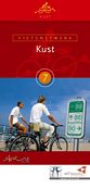 Order Map |
For more detailed information about the Cycle Network Kust consult the website of the Tourism Office of
West-Vlaanderen: www.fietsen-wandelen.be |
Cycle Network Leiestreek
The Leie (La Lys in France) is the major tributary of the Schelde in Flanders. This portion of the river is basically wild, meandering through flat farmland with occasional picturesque villages. Passage on most of this section is limited to 300 tons - in effect only pleasure boats. Much of the riverside has been divided into large lots, which have the greatest collection of large mansions.Discover the villages of Afsnee, Sint-Martens-Latem, Deurle, Sint-Martens-Leerne, and the Castel of Ooidonk. Along the way you pass through some of the poshest housing development in Belgium, particularly in the Latem area. The houses along the river tend to be mansions with very large grounds. Ooidonk was founded in the 12th century. What you see today is mostly 16th. The chateau is approached from Bachte-Maria-Leerne, on a road running south from the church (12 - 16th centuries, rehabbed 17th century). (There are several pubs on the two main streets of the town.)
Kortrijk lies in the Belgian Province of West Flanders, on the river Leie. Kortrijk dates from Roman times, when it was called Cortoriacum. Destroyed by the Normans, it was rebuilt in the 10th century by Baldwin III, count of Flanders. The town became an important center of trade and at its height had a population of about 200,000 The river Leie comes from France and enters Kortrijk on the site of the "Broeltorens", two medieval towers that are the only remaining witnesses of the former city fortifications, destroyed in 1684 by the troops of Louis XIV of France. Both towers date from the 12th and 13th century.
Order Map |
Order Map |
For more detailed information about the Cycle Network Leiestreek consult the website of the Tourism Office of the
Leiestreek: www.leiestreek.be |
Cycle Network Westhoek
From the dunes on the West Coast to Kemmel Hill (Kemmelberg), from the Hoppeland in Poperinge to the Handzamevallei. In this agriculture-dominated area, you can find an abundance of many different types of greenery and untouched nature spots.The landscape of The Yser Valley, which runs through the northern part of the Westhoek towards the sea, exudes unspoiled natural beauty in a green environment. When you follow Dixmude (Diksmuide) upstream, you can continue through St-Jacobskapelle and again along the Yser or through the Old Sea Dike (Oude Zeedijk) to the Knokke Bridge (Knokkebrug). Here, you have the option to turn to the left where you will discover the verdant banks of the Yperlee Canal (Ieperleekanaal) towards the Driegrachtenbrug.
Ypres is a pleasant town with an air of old world, however all the ancient building are a sham, everything has been lovingly restored after the complete destruction caused by four year of warfare. During the First Battle of Ypres (Oct-Nov 1914), the Kaiser ordered his troops that they 'Take Ypres or die', and die they did. All but for a short period in Oct 1914, Ypres remained in allied hands, although at a cost. Through out the war Ypres formed a significant Salient up on the Western Front.
Some interesting links about Ypres:
 Order Map |
 Order Map |
For more detailed information about the Cycle Network Westhoek consult the website of the Tourism Office of the
Westhoek: www.toerismewesthoek.be |